|
| Maquinna Point |
Isolated.
Rugged.
Awe-inspiring.
But most of all, humbling.
Yes, the Nootka Island Trail is all of these.
Isolated because it is an island off the north-west coast of Vancouver Island, accessible only by boat or float plane.

Rugged because of its jagged coastline and challenging "trail."

Awe-inspiring because of the beauty of not only the rock formations and cliffs along the shore, but because of the lush first-growth forest.

And humbling because of the physical demands of this short hike (only 35-40 k.) due to the ups and downs along the coast and the ruggedness of the inland trail, up and over logs and around obstacles.

We started out with an hour and a half water taxi ride on Saturday, July 9th from Tahsis to Tongue Point at the northern end of Nootka Island. It was a beautiful ride in an open boat with Tahtsa Dive Charters, mostly smooth, except for some rough waters in Gillam Channel as we rounded the north west point of Nootka. We enjoyed seeing a raft of sea otters in a kelp bed, but mostly we enjoyed the dry weather, as rain had been forecast.


The tide was ebbing when we reached Tongue Point at 8:30, and we set off across the rocks and along the exposed mud flats. With the low tide at 10:30 (.9 m.) this gave us ample time to cross the surge channel on the west side of the island before the tide would be too high.

 |
| "Wow, look at this old shipwreck.!" |
 |
| "This is easy going here." |
 |
| Nearing the surge channel, and the trail head crossing the headland. |
After about an hour, we reached the trail that cut across the headlands leading to Third Beach (also called First Beach). Most people take a float plane into Louie Lagoon and then take a short hike across to Third Beach, so this section sees little traffic, and was correspondingly bushy and rugged.
 |
| "Do you want a hand?" |
 |
| "Be careful!" |
And, with the recent rain, the trail was a little "soggy" in places.
 |
| "Where do we go?!" |
After one detour, we reached Third Beach at 12:30, just in time to set up camp, have lunch, and relax.
 |
| "Ah, this is the life!" |
We did have some showers in the afternoon, but we were grateful for the "good" weather. One other group of three hikers (and their Golden Retriever) took the float plane in and hiked across to "our" beach and camped a few hundred meters north of us along the shore.
 |
| Clouds draping the hills at Third Beach. |
 |
| Scenes at Third Beach. |
 |
| Packing up Sunday morning, in sunshine! "Yahoo!" |
Sunday we hiked from Third Beach to Calvin Falls, with about five hours of hiking, some of it on bushy trail, but most along the wonderful shore.
 |
| The trail around the first headland. |
 |
| "Ah, so nice to come back down to the shore!" |
 |
| "Oh, this sunshine is a bonus!" |
But then, about an hour after we had started out, Mo stepped in a hole and twisted her ankle. Since she was unable to walk, Ken and Clarke both activated their SPOT devices, and just two hours later an RCMP helicopter arrived.
 |
| "Oh, I hope it doesn't take too long." |
 |
| The chopper leaving. The pilot flew it over from Courtenay and picked up the two RCMP officers in Gold River. |
 |
| Some more breath-taking scenery on the way to Calvin Falls. |
 |
| A good flow at Calvin Falls with the recent rain. |
 |
| "So nice to have shelter from the rain in this old surfers' camp!" |
 |
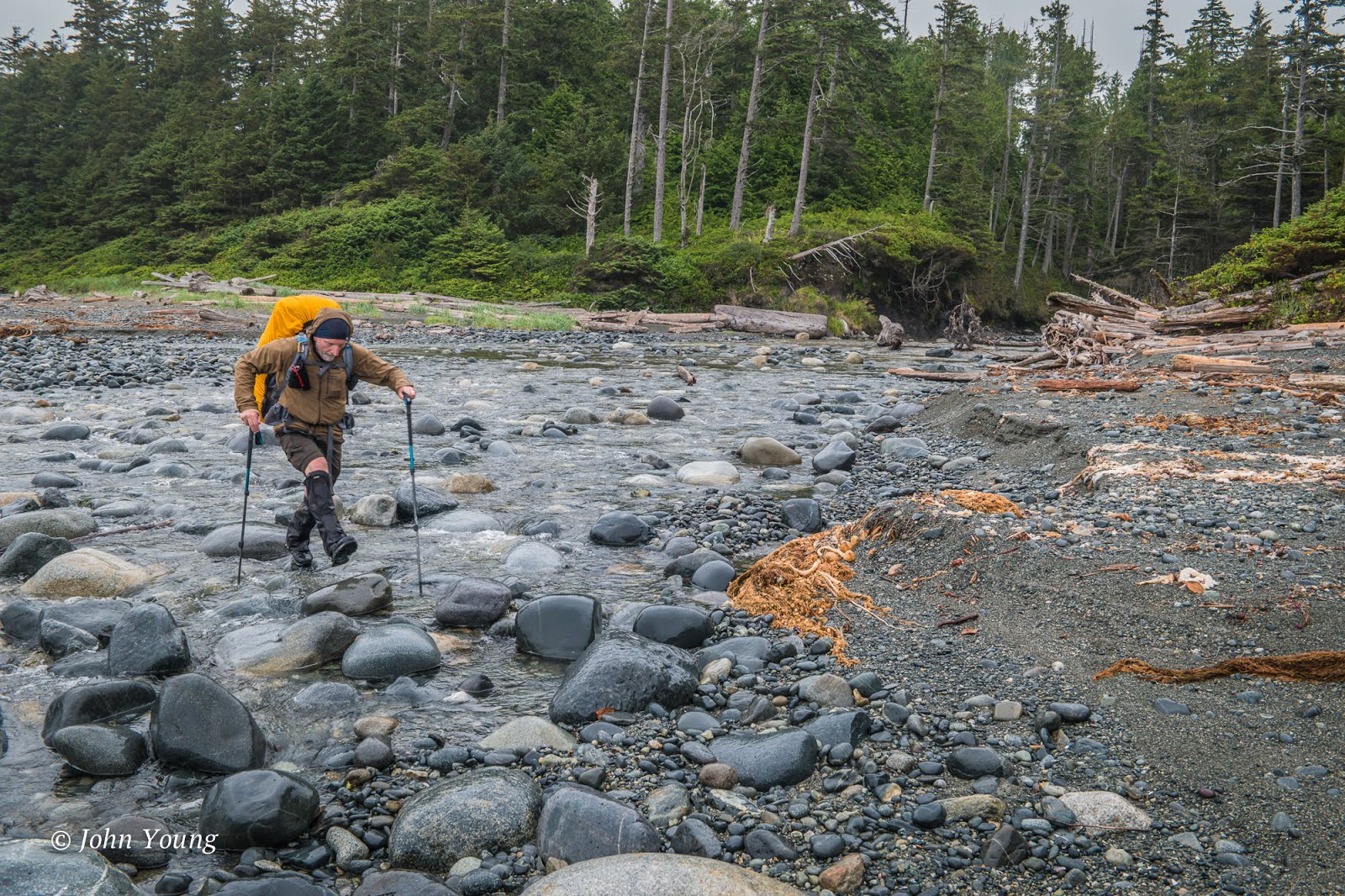
| We started off on a drizzly Monday morning with a ford of Calvin Creek. |
 |
| "If I step fast enough maybe I won't fill my boots!" |
 |
| It rained off and on on our way to Beano Creek, about a four-hour jaunt. |
When we arrived at Beano Creek, it was drizzling and windy, so we found a sheltered spot along the creek, set up our two tarps, and were quite comfortable under the trees.
 |
| "Ah, this fire is so nice!" |
 |
| I went out onto the point to make some pictures. |
 |
| After taking this shot, I started back when a rogue wave swept up over the sand and elevated my heart rate when it washed up to my ankles. |
 |
| Tuesday morning was a soggy affair! |
 |
| But then the rain let up, |
 |
| and the sun came out! |
 |
| And then we neared Maquinna Pt., the most scenic section of the hike. |
 |
| Maquinna Pt. |
 |
| Tuesday night we camped at my "secret cove." A hidden beach down a trail girded by salal. We were treated to the glow of the sun on far-off Hesquiat Peninsula. |
 |
| Wednesday dawned clear, and we had two hours of fabulous hiking before reaching the lagoon near Yuquot (Friendly Cove.) |
 |
| I had been informed that a party last year had crossed the lagoon mouth at a tide of 1.6 m., and it was chest high. The lowest tide for us on Wednesday was 1.8 m., so I had fore-warned the others that we would be swimming across. We reached the lagoon just before 11 at a tide of 2.3 m., and were over-joyed to find it easy crossing! The sands must've shifted since last summer. |
 |
| Nearing Yuquot (one hour from the lagoon) |
 |
| A happy group at the end of our hike! |


 Wow! Look at this maple tree!